The Moon Map Made by Earth Geologists
USGS Astrogeology built a unified geologic map of the Moon, turning Apollo-era mapping and modern spacecraft data into one global reference.
A world no one can walk across easily
Geologic maps are familiar on Earth: colors, boundaries, faults, ages, and rock units turned into a readable surface. The Moon needs the same treatment, even though no field geologist can spend a season walking across it with a hammer.
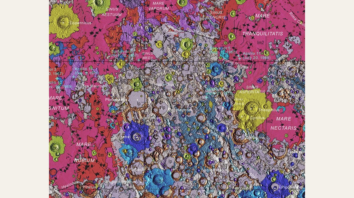
That is where spacecraft data and older mapping come together. The USGS Unified Geologic Map of the Moon summarizes lunar surface geology at global scale, using Apollo-era regional maps and newer mission data.
The Moon becomes layered, not just gray
To casual eyes, the Moon is gray: bright highlands, dark maria, craters everywhere. A geologic map breaks that surface into history. Different colors mark units with different origins and ages, from lava plains to impact materials.
The point is not only to make a beautiful poster. The map gives researchers, educators, and mission planners a shared reference for talking about where things are and what they may be made of.
Why Earth skills matter off Earth
USGS Astrogeology exists partly because planetary exploration still needs the old discipline of mapping. A rover route, a landing site, or a sample return plan all depend on understanding terrain.
The impossible-looking part is that geology can cross worlds. The tools began with Earth, but the logic travels: observe, classify, map, test, revise.